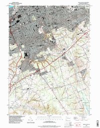
1996 Map of Erie South
USGS Topo · Published 1997About this map
The urban landscape of Erie dominates this 1996 revision, showcasing the dense street grid and institutional anchors of the city. A high concentration of educational and religious landmarks, including Villa Maria College, Cathedral Prep High Sch, and Gridley High Sch, illustrates the mid-century social infrastructure that remained central to the community's identity. The map captures the city as it transitions from its lakefront industrial roots, represented by the Conrail lines, toward the expanding commercial corridors of Summit Township and the suburban growth at Belle Valley.
Find a feature on this map
68 named features on this map. Tap any name to fly to it.
Don’t see what you’re looking for? This feature index may not catch every label — zoom into the map to look around manually.
Map Details
Editions of this 1996 Erie South Map
This is the sole edition of this map. No revisions or reprints were ever made.
Other maps of this area

1899 · Erie
USGS Topo · 1:62,500

1900 · Erie
USGS Topo · 1:62,500

1913 · North East
USGS Topo · 1:62,500

1915 · North East
USGS Topo · 1:62,500

1923 · Cambridge Springs
USGS Topo · 1:62,500

1925 · Cambridge Springs
USGS Topo · 1:62,500

1929 · Union City
USGS Topo · 1:62,500

1932 · Union City
USGS Topo · 1:62,500

1943 · North East
USGS Topo · 1:62,500

1943 · Cambridge Springs
USGS Topo · 1:62,500