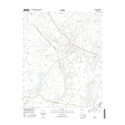
2016 Map of Erwin
USGS Topo · Published 2016About this map
The Cape Fear River and Little River converge in this part of North Carolina, shaping the low-lying terrain of the southern coastal plain. The settlement of Erwin serves as a central hub, flanked by the larger community of Dunn to the east and the small village of Linden to the south. This geography is defined by its complex drainage network, where the Beaverdam Swamp Canal and Thorntons Cr cut through the landscape, alongside smaller water bodies like Jernigans Pond. Local history and genealogy interest is concentrated at the Averasboro Cem, located near the Harnett and Cumberland county line. The map illustrates a transitional landscape where agriculture and rural residences meet the expanding footprints of the regional towns, connected by a dense web of roads such as Prospect Church Rd and Old Stage Rd S.
Find a feature on this map
125 named features on this map. Tap any name to fly to it.
Don’t see what you’re looking for? This feature index may not catch every label — zoom into the map to look around manually.
Map Details
Editions of this 2016 Erwin Map
This is the sole edition of this map. No revisions or reprints were ever made.
Other maps of this area
1948 · Fayetteville
USGS Topo · 1:62,500
1948 · Slocomb
USGS Topo · 1:24,000
1950 · Slocomb
USGS Topo · 1:24,000
1953 · Raleigh
USGS Topo · 1:250,000
1954 · Raleigh
USGS Topo · 1:250,000
1956 · Bunnlevel
USGS Topo · 1:24,000
1957 · Fayetteville
USGS Topo · 1:62,500
1973 · Benson
USGS Topo · 1:24,000
1973 · Dunn
USGS Topo · 1:24,000
1973 · Erwin
USGS Topo · 1:24,000