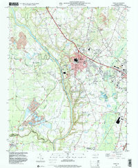
1997 Map of Erwin
USGS Topo · Published 2000About this map
The Cape Fear River and Little River converge in this corner of North Carolina, shaping the growth of Erwin and the nearby city of Dunn. This survey documents the landscape's evolution from its river-centered roots to its modern industrial and residential layout at the end of the millennium. The town of Erwin is prominently detailed with its street grid, High Sch, and the significant industrial footprint of the Sewage Disposal and Filtration Plant facilities.
Find a feature on this map
35 named features on this map. Tap any name to fly to it.
Don’t see what you’re looking for? This feature index may not catch every label — zoom into the map to look around manually.
Map Details
Editions of this 1997 Erwin Map
This is the sole edition of this map. No revisions or reprints were ever made.
Other maps of this area

1948 · Fayetteville
USGS Topo · 1:62,500

1948 · Slocomb
USGS Topo · 1:24,000

1950 · Slocomb
USGS Topo · 1:24,000

1953 · Raleigh
USGS Topo · 1:250,000

1954 · Raleigh
USGS Topo · 1:250,000

1956 · Bunnlevel
USGS Topo · 1:24,000

1957 · Fayetteville
USGS Topo · 1:62,500

1973 · Benson
USGS Topo · 1:24,000

1973 · Dunn
USGS Topo · 1:24,000

1973 · Erwin
USGS Topo · 1:24,000