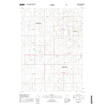
2018 Map of Esau Spring
USGS Topo · Published 2018About this map
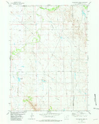
Thunder Basin National Grassland dominates this portion of Converse County, where the high plains landscape is defined by an intricate network of ephemeral watercourses and draws. The map illustrates a drainage pattern radiating from the interior, with Tena Cr and Cow Cr flowing toward the east and south, while Rat Cr and Little Rat Cr carve into the southwestern terrain. This area is characterized by open ranching lands, marked by family-named landmarks like Riehle Draw and Archie Draw that suggest the legacy of local landholders. The presence of Esau Spring in the northern reaches serves as a vital water source in this semi-arid environment, anchoring a section of the grassland where the public domain meets private ranching interests, as evidenced by the established boundary of t39n r68w.
Find a feature on this map
26 named features on this map. Tap any name to fly to it.
Don’t see what you’re looking for? This feature index may not catch every label — zoom into the map to look around manually.
Map Details
Editions of this 2018 Esau Spring Map
This is the sole edition of this map. No revisions or reprints were ever made.
Other maps of this area

1955 · Newcastle
USGS Topo · 1:250,000

1958 · Newcastle
USGS Topo · 1:250,000
1970 · Bill 4 NW
USGS Topo · 1:24,000
1970 · Bill 4 NE
USGS Topo · 1:24,000
1971 · Fiddleback Ranch
USGS Topo · 1:24,000
1971 · Coal Bank Draw
USGS Topo · 1:24,000
1971 · Esau Spring
USGS Topo · 1:24,000
1971 · Tin Can Lake
USGS Topo · 1:24,000
1979 · Bill
USGS Topo · 1:100,000
1981 · Wagonhound Creek
USGS Topo · 1:24,000