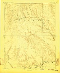
1886 Map of Escalante
USGS Topo · Published 1910About this map
Escalante and Paria stand as the primary outposts of human habitation in this late 19th-century reconnaissance of Southern Utah. Surveyed by the Powell Survey, the map documents the intricate drainage systems and massive geological formations of Garfield and Kane counties. The landscape is dominated by high-altitude features like the Aquarius Plateau and the Kaiparowits Plateau, which are dissected by numerous waterways including Birch Creek, Mamie Creek, and Boulder Creek. One of the most historically significant markers is The Crossing of the Fathers on the lower reaches of the Paria River, a vital historical transit point before modern infrastructure. The map also delineates the northern extent of the Navajo Indian Res. Line near the Utah Arizona Boundary Line, capturing the frontier character of the region as it was systematically documented for the first time.
Find a feature on this map
26 named features on this map. Tap any name to fly to it.
Don’t see what you’re looking for? This feature index may not catch every label — zoom into the map to look around manually.
Map Details
Editions of this 1886 Escalante Map
5 editions found
Other maps of this area

1883 · Marsh Pass
USGS Topo · 1:250,000

1885 · San Rafael
USGS Topo · 1:250,000

1885 · Beaver
USGS Topo · 1:250,000

1885 · Fish Lake
USGS Topo · 1:250,000

1886 · Kanab
USGS Topo · 1:250,000

1886 · Escalante
USGS Topo · 1:250,000

1886 · Henry Mountains
USGS Topo · 1:250,000

1886 · Echo Cliffs
USGS Topo · 1:250,000

1886 · Kaibab
USGS Topo · 1:250,000

1891 · Echo Cliffs
USGS Topo · 1:250,000