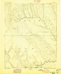
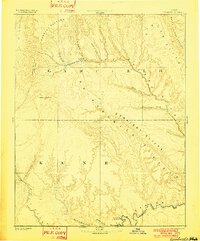
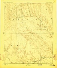
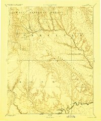
1886 Map of Escalante
USGS Topo · Published 1896About this map
Escalante and the remote settlement of Paria anchor this late-nineteenth-century survey of the high desert along the border of Garfield and Kane counties. Mapping by the Powell Survey reveals a landscape dominated by massive geological formations, from the high timber of the Aquarius Plateau to the stark Straight Cliffs and Kaiparowits Plateau. The drainage patterns are meticulously traced, following the Escalante River through Potato Valley and southward toward the Navajo Indian Res Line.
Find a feature on this map
26 named features on this map. Tap any name to fly to it.
Don’t see what you’re looking for? This feature index may not catch every label — zoom into the map to look around manually.
Map Details
Editions of this 1886 Escalante Map
5 editions found
Other maps of this area

1883 · Marsh Pass
USGS Topo · 1:250,000

1885 · San Rafael
USGS Topo · 1:250,000

1885 · Beaver
USGS Topo · 1:250,000

1885 · Fish Lake
USGS Topo · 1:250,000

1886 · Kanab
USGS Topo · 1:250,000

1886 · Escalante
USGS Topo · 1:250,000

1886 · Henry Mountains
USGS Topo · 1:250,000

1886 · Echo Cliffs
USGS Topo · 1:250,000

1886 · Kaibab
USGS Topo · 1:250,000

1891 · Echo Cliffs
USGS Topo · 1:250,000