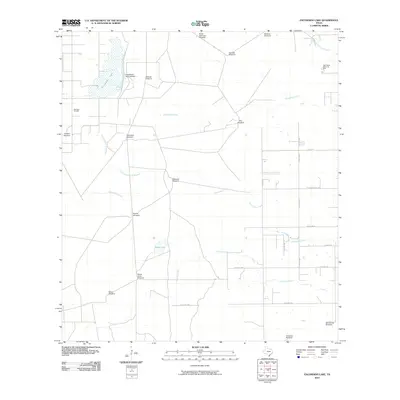
2010 Map of Escondido Lake
USGS Topo · Published 2010About this map
Escondido Lake and the infrastructure of the King Ranch dominate this South Texas landscape, where water management is central to the regional economy. The presence of King Ranch Dam Number 7 and a dense network of named windmills, such as the Santa Gertrudis Windmill, Monte Verde Windmill, and Escondido Windmill, illustrate the historic and ongoing reliance on groundwater for ranching operations. The terrain is defined by seasonal drainages including Escondido Creek, Jaboncillos Creek, and Ebanito Creek, alongside the topographic feature known as Derramadero de Machos. While much of the area remains dedicated to large-scale ranching, industrial activity appears at the Borregos Oil Field in the west, while the northeast corner shows the edge of local development at Rest Haven Memorial Park.
Find a feature on this map
32 named features on this map. Tap any name to fly to it.
Don’t see what you’re looking for? This feature index may not catch every label — zoom into the map to look around manually.
Map Details
Editions of this 2010 Escondido Lake Map
This is the sole edition of this map. No revisions or reprints were ever made.
Other maps of this area

1917 · Ben Bolt
USGS Topo · 1:62,500

1921 · Falfurrias
USGS Topo · 1:125,000

1928 · Sarita
USGS Topo · 1:125,000

1950 · Corpus Christi
USGS Topo · 1:250,000

1954 · Kingsville
USGS Topo · 1:62,500

1954 · Riviera
USGS Topo · 1:62,500

1956 · Corpus Christi
USGS Topo · 1:250,000

1956 · Laredo
USGS Topo · 1:250,000

1960 · Corpus Christi
USGS Topo · 1:250,000

1963 · Ben Bolt SE
USGS Topo · 1:24,000