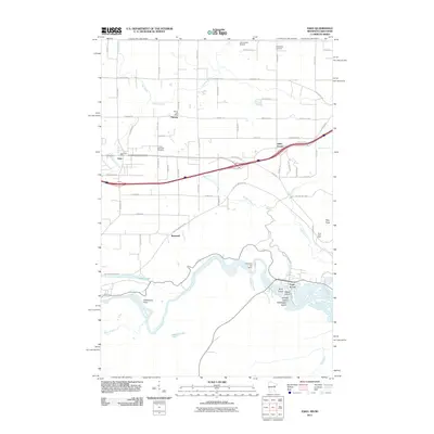
2011 Map of Esko
USGS Topo · Published 2011About this map
The Saint Louis River snakes through the southern reaches of this landscape, carving a valley defined by prominent overlooks such as Oldenburg Point. Near the river's bend, the Fond du Lac Dam regulates the water, flanked by riverine landmarks like Wahbegon Island and Nekuk Island. Northward, the terrain transitions into a more settled corridor where the community of Esko and the Harney Post Office serve as local hubs. This area is deeply tied to its rural roots, as evidenced by numerous family and community burial grounds including the Finnish Apostolic Cemetery, Augustana Cemetery, and Lennartson Cemetery.
Find a feature on this map
72 named features on this map. Tap any name to fly to it.
Don’t see what you’re looking for? This feature index may not catch every label — zoom into the map to look around manually.
Map Details
Editions of this 2011 Esko Map
This is the sole edition of this map. No revisions or reprints were ever made.
Other maps of this area

1895 · Duluth
USGS Topo · 1:62,500

1915 · Superior
USGS Topo · 1:48,000

1917 · Superior
USGS Topo · 1:62,500

1953 · Saginaw
USGS Topo · 1:24,000

1953 · Adolph
USGS Topo · 1:24,000

1953 · Duluth Heights
USGS Topo · 1:24,000

1953 · Duluth
USGS Topo · 1:62,500

1953 · Duluth
USGS Topo · 1:250,000

1954 · West Duluth
USGS Topo · 1:24,000

1954 · Cloquet
USGS Topo · 1:24,000