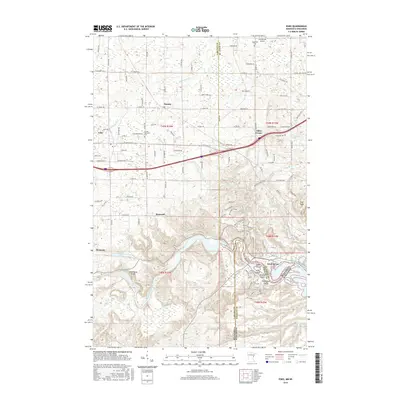
2016 Map of Esko
USGS Topo · Published 2016About this map
The Saint Louis River carves a dramatic path through this 2016 survey, defining the border between Minnesota and Wisconsin. This specific reach is characterized by its complex river geography, featuring a cluster of named islands including Nekuk Island, Amik Island, Ondaig Island, and Wahbegon Island just downstream from the historic Fond du Lac settlement. The landscape transitions from the river valley's bottomlands up toward the prominent Oldenburg Point and the high elevation of Elys Peak, where the rugged topography overlooking the river corridor becomes evident.
Find a feature on this map
115 named features on this map. Tap any name to fly to it.
Don’t see what you’re looking for? This feature index may not catch every label — zoom into the map to look around manually.
Map Details
Editions of this 2016 Esko Map
This is the sole edition of this map. No revisions or reprints were ever made.
Other maps of this area

1895 · Duluth
USGS Topo · 1:62,500

1915 · Superior
USGS Topo · 1:48,000

1917 · Superior
USGS Topo · 1:62,500

1953 · Saginaw
USGS Topo · 1:24,000

1953 · Adolph
USGS Topo · 1:24,000

1953 · Duluth Heights
USGS Topo · 1:24,000

1953 · Duluth
USGS Topo · 1:62,500

1953 · Duluth
USGS Topo · 1:250,000

1954 · West Duluth
USGS Topo · 1:24,000

1954 · Cloquet
USGS Topo · 1:24,000