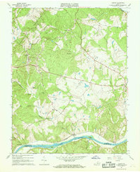
1967 Map of Esmont
USGS Topo · Published 1968About this map
Green Mountain dominates the western landscape of this mid-1960s survey, rising above a network of small settlements and agricultural sites in Albemarle County. The James River forms the southern boundary, where the Chesapeake and Ohio railway follows the riverbank past Warren and Hatton. This era shows a community defined by its rural centers, such as Esmont and Keene, which were connected by a web of local roads and remnants of older infrastructure like the Old Railroad Grade. Cultural landmarks are densely distributed, including the Yancy Sch and numerous community churches like St Stephens Ch and Mt Zion Ch. Near the eastern edge, the town of Scottsville serves as a primary hub, while industrial activity is represented by a Quarry located along Rock Castle Creek. The map provides a look at the Piedmont region before modern suburbanization, where topographic details record every creek and farm boundary.
Find a feature on this map
44 named features on this map. Tap any name to fly to it.
Don’t see what you’re looking for? This feature index may not catch every label — zoom into the map to look around manually.
Map Details
Editions of this 1967 Esmont Map
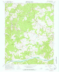
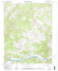
Other maps of this area

1891 · Palmyra
USGS Topo · 1:125,000

1892 · Buckingham
USGS Topo · 1:125,000

1895 · Palmyra
USGS Topo · 1:125,000

1897 · Palmyra
USGS Topo · 1:125,000

1929 · Covesville
USGS Topo · 1:62,500

1935 · Covesville
USGS Topo · 1:62,500

1943 · Scottsville
USGS Topo · 1:62,500

1945 · Covesville
USGS Topo · 1:62,500

1946 · Scottsville
USGS Topo · 1:62,500

1947 · Roanoke
USGS Topo · 1:250,000