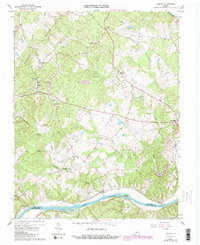
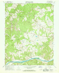
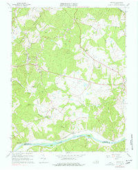
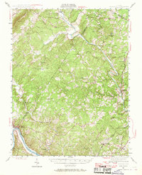
1967 Map of Esmont
USGS Topo · Published 1987About this map
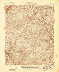
The James River defines the southern boundary of this Albemarle County landscape, where the historical villages of Warren and Hatton once thrived as centers of river commerce. Further inland, the ridge of Green Mountain dictates the local geography, with numerous small streams like Totier Creek and Ballinger Creek carving through the terrain. The presence of Dawson Mill and an old Quarry suggests a legacy of local industry tied to the land's natural resources.
Find a feature on this map
41 named features on this map. Tap any name to fly to it.
Don’t see what you’re looking for? This feature index may not catch every label — zoom into the map to look around manually.
Map Details
Editions of this 1967 Esmont Map
Other maps of this area

1891 · Palmyra
USGS Topo · 1:125,000

1892 · Buckingham
USGS Topo · 1:125,000

1895 · Palmyra
USGS Topo · 1:125,000

1897 · Palmyra
USGS Topo · 1:125,000

1929 · Covesville
USGS Topo · 1:62,500

1935 · Covesville
USGS Topo · 1:62,500
1943 · Scottsville
USGS Topo · 1:62,500

1945 · Covesville
USGS Topo · 1:62,500
1946 · Scottsville
USGS Topo · 1:62,500

1947 · Roanoke
USGS Topo · 1:250,000