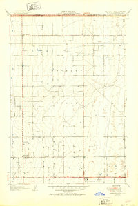
1951 Map of Esperanza School
USGS Topo · Published 1951About this map
The Antelope Valley floor, straddling the border of Kern and Los Angeles counties, reveals a landscape defined by an emerging agricultural grid and early aviation markers in the early 1950s. The surveyor T.H. Moncure revised the culture of this quadrangle, documenting a sparse but structured network of roads like Avenue A and Neenach Road. Education and community hubs are centered at the West Side Union Sch, while the map also preserves the locations of older educational landmarks such as Old Rogers Sch and Old Esperanza Sch. The southern portion of the sheet highlights logistical development in the high desert, including the War Eagle Airfield, a Water Tank, and a Sub Station. Countless labels for Well indicate the critical importance of groundwater management for the homesteads and farms scattered across these sections.
Find a feature on this map
19 named features on this map. Tap any name to fly to it.
Don’t see what you’re looking for? This feature index may not catch every label — zoom into the map to look around manually.
Map Details
Editions of this 1951 Esperanza School Map
2 editions found
Other maps of this area

1915 · Elizabeth Lake
USGS Topo · 1:125,000

1917 · Elizabeth Lake
USGS Topo · 1:125,000

1930 · Oban
USGS Topo · 1:24,000

1930 · Lancaster
USGS Topo · 1:24,000

1931 · Little Buttes
USGS Topo · 1:24,000

1931 · Del Sur
USGS Topo · 1:24,000

1931 · Esperanza School
USGS Topo · 1:24,000

1932 · Lake
USGS Topo · 1:24,000

1933 · Lancaster
USGS Topo · 1:24,000

1933 · Oban
USGS Topo · 1:24,000