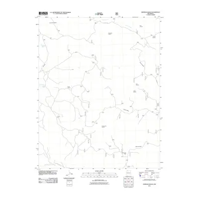
2011 Map of Espinosa Ranch
USGS Topo · Published 2011About this map
Espinosa Ranch and the small settlement of Palmer sit at the center of this high-altitude landscape in Rio Arriba County. The terrain is defined by a series of complex drainages and expansive plateaus, including Laguna Seca Mesa and Cabresto Mesa. To the southeast, the elevation rises toward Mestenas Peak, overlooking the broad Mestenas Mesa. Water sources are sparse but critical in this region, marked by features such as Laguna Seca, Lopez Lake, and the winding course of Cabresto Creek.
Find a feature on this map
22 named features on this map. Tap any name to fly to it.
Don’t see what you’re looking for? This feature index may not catch every label — zoom into the map to look around manually.
Map Details
Editions of this 2011 Espinosa Ranch Map
This is the sole edition of this map. No revisions or reprints were ever made.
Other maps of this area

1889 · Largo
USGS Topo · 1:250,000

1895 · Largo
USGS Topo · 1:250,000

1954 · Rosa
USGS Topo · 1:24,000

1954 · Gomez Ranch
USGS Topo · 1:24,000

1954 · Aztec
USGS Topo · 1:250,000

1958 · Aztec
USGS Topo · 1:250,000

1962 · Aztec
USGS Topo · 1:250,000

1963 · Fourmile Canyon
USGS Topo · 1:24,000
1963 · Espinosa Ranch
USGS Topo · 1:24,000

1963 · Gobernador
USGS Topo · 1:24,000