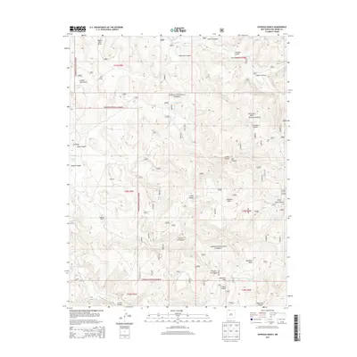
2013 Map of Espinosa Ranch
USGS Topo · Published 2013About this map
Espinosa Ranch and the small settlement of Espinoza anchor this portion of Rio Arriba County, illustrating the sparse human footprint within the high mesa country of the Carson National Forest. The landscape is defined by its verticality and water management, where numerous tanks such as La Fragua Tank and Shale Tank were established to capture runoff in a region dominated by deep drainages like American Canyon and Chicken Fry Canyon. This 2013 survey shows the intricate system of canyons and mesas, including the prominent Mesteñas Peak and Cabresto Mesa, which characterize the high-altitude terrain. The presence of named water sources like Manuel Spring and Two Trough Spring among the draws of Ulibarri Canyon and Oso Canyon highlights the critical importance of reliable water for ranching and forest management in this arid northern New Mexico environment.
Find a feature on this map
43 named features on this map. Tap any name to fly to it.
Don’t see what you’re looking for? This feature index may not catch every label — zoom into the map to look around manually.
Map Details
Editions of this 2013 Espinosa Ranch Map
This is the sole edition of this map. No revisions or reprints were ever made.
Other maps of this area

1889 · Largo
USGS Topo · 1:250,000

1895 · Largo
USGS Topo · 1:250,000

1954 · Rosa
USGS Topo · 1:24,000

1954 · Gomez Ranch
USGS Topo · 1:24,000

1954 · Aztec
USGS Topo · 1:250,000

1958 · Aztec
USGS Topo · 1:250,000

1962 · Aztec
USGS Topo · 1:250,000

1963 · Fourmile Canyon
USGS Topo · 1:24,000
1963 · Espinosa Ranch
USGS Topo · 1:24,000

1963 · Gobernador
USGS Topo · 1:24,000