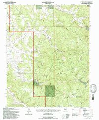
1995 Map of Espinosa Ranch
USGS Topo · Published 1997About this map
Espinosa Ranch sits at the heart of this high-desert landscape in northern New Mexico, surrounded by a complex network of canyons and mesas within the Carson National Forest. The 1990s terrain is defined by its industrial layer, where numerous labels for Gas Wells and an extensive network of pipelines crisscross the drainage systems of Cabresto Canyon and American Canyon. This juxtaposition of resource extraction and rugged topography is evident as lines cut across prominent landforms like Laguna Seca Mesa and Mesteñas Mesa.
Find a feature on this map
34 named features on this map. Tap any name to fly to it.
Don’t see what you’re looking for? This feature index may not catch every label — zoom into the map to look around manually.
Map Details
Editions of this 1995 Espinosa Ranch Map
This is the sole edition of this map. No revisions or reprints were ever made.
Other maps of this area

1889 · Largo
USGS Topo · 1:250,000

1895 · Largo
USGS Topo · 1:250,000

1954 · Rosa
USGS Topo · 1:24,000

1954 · Gomez Ranch
USGS Topo · 1:24,000

1954 · Aztec
USGS Topo · 1:250,000

1958 · Aztec
USGS Topo · 1:250,000

1962 · Aztec
USGS Topo · 1:250,000

1963 · Fourmile Canyon
USGS Topo · 1:24,000
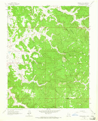
1963 · Espinosa Ranch
USGS Topo · 1:24,000

1963 · Gobernador
USGS Topo · 1:24,000