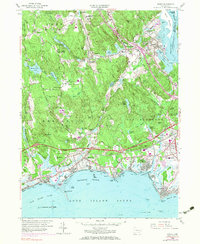
1958 Map of Essex
USGS Topo · Published 1983About this map
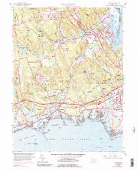
The Connecticut River marks the eastern boundary of this mid-century coastal landscape, where the tidal waters of North Cove and South Cove meet the historic seafaring village of Essex. Inland, the terrain is defined by a series of ponds and small millstreams, such as Birch Millpond and Chalkers Millpond, which once powered local industry. The settlement pattern shows the inland manufacturing influence of Ivoryton and Centerbrook contrasting with the growing recreational shoreline at Westbrook and Old Saybrook. Transportation networks are in transition, featuring the Penn Central railroad and the Connecticut Toll Road cutting across the coastal plain. Family and community roots are preserved at the Central Burying Ground and Riverview Cem, while the wooded uplands of the Cockaponset State Forest overlook the burgeoning residential developments of Saybrook Manor and Knollwood.
Find a feature on this map
93 named features on this map. Tap any name to fly to it.
Don’t see what you’re looking for? This feature index may not catch every label — zoom into the map to look around manually.
Map Details
Editions of this 1958 Essex Map
5 editions found
Other maps of this area

1893 · Guilford
USGS Topo · 1:62,500

1893 · Saybrook
USGS Topo · 1:62,500

1941 · Lyme
USGS Topo · 1:31,680

1944 · Essex
USGS Topo · 1:31,680

1944 · Deep River
USGS Topo · 1:31,680
1947 · Orient
USGS Topo · 1:24,000

1947 · Hartford
USGS Topo · 1:250,000

1948 · Hartford
USGS Topo · 1:250,000
1951 · Lyme
USGS Topo · 1:31,680

1951 · Clinton
USGS Topo · 1:31,680