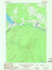
1987 Map of Estcourt
USGS Topo · Published 1987About this map
The St Francis River defines the international boundary between Maine and Québec, creating a unique cross-border settlement pattern where Estcourt and Sully sit directly against the Canadian line. This late-twentieth-century survey illustrates the remote character of Big Twenty, a township dominated by timberlands and a network of waterways including Wildcat Brook, Chisholm Brook, and Dead Brook. Cultural features are concentrated along the northern edge, where the population centers of Village-Blier and the outskirts of Ville De Pohénégamook meet the southern tip of Lac Pohénégamook. The presence of an Air Strip and several Gravel Pits among the international monuments, such as Int'l Mon 181, suggests an economy tied to both local extraction and the logistical needs of this isolated border crossing.
Find a feature on this map
33 named features on this map. Tap any name to fly to it.
Don’t see what you’re looking for? This feature index may not catch every label — zoom into the map to look around manually.
Map Details
Editions of this 1987 Estcourt Map
This is the sole edition of this map. No revisions or reprints were ever made.
Other maps of this area

1955 · Rocky Brook
USGS Topo · 1:62,500

1955 · Beau Lake
USGS Topo · 1:62,500

1962 · Edmundston
USGS Topo · 1:250,000
1986 · Landry
USGS Topo · 1:24,000

1987 · Beau Lake
USGS Topo · 1:24,000

1987 · Hafey Pond
USGS Topo · 1:24,000
1987 · Saint-Eleuthere
USGS Topo · 1:24,000
1987 · Rocky Brook
USGS Topo · 1:24,000
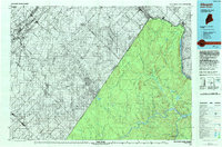
1993 · Allagash
USGS Topo · 1:100,000
2011 · Saint Eleuthere
USGS Topo · 1:24,000