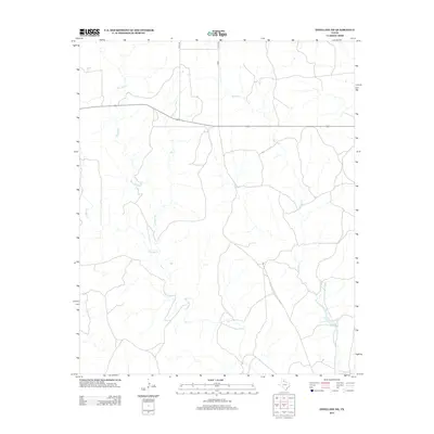
2013 Map of Estelline NE
USGS Topo · Published 2013About this map
Wet Salt Cr and its tributaries carve a network of drainage through this portion of the Texas Panhandle, defining the hydrography of a rural landscape primarily shaped by intermittent watercourses. The drainage patterns of Dry Salt Cr and Salt Cr suggest a terrain influenced by seasonal flows, a characteristic feature of Childress County geography. The few established transportation routes through this area include Highway 256 and a sparse network of local roads such as Co RD 120 and Co RD 7. This 2013 survey illustrates the modern layout of these rural corridors and their relationship to the natural watershed of Horse Cr, providing a clear view of the land's contemporary use and its fundamental environmental structure.
Find a feature on this map
8 named features on this map. Tap any name to fly to it.
Don’t see what you’re looking for? This feature index may not catch every label — zoom into the map to look around manually.
Map Details
Editions of this 2013 Estelline NE Map
This is the sole edition of this map. No revisions or reprints were ever made.
Other maps of this area

1954 · Plainview
USGS Topo · 1:250,000

1958 · Plainview
USGS Topo · 1:250,000

1960 · Loco
USGS Topo · 1:62,500

1961 · Estelline
USGS Topo · 1:62,500

1964 · Rolla SW
USGS Topo · 1:24,000

1964 · Wellington
USGS Topo · 1:24,000

1964 · Rolla
USGS Topo · 1:24,000

1984 · Estelline NE
USGS Topo · 1:24,000
1984 · Loco
USGS Topo · 1:24,000
1984 · Estelline NW
USGS Topo · 1:24,000