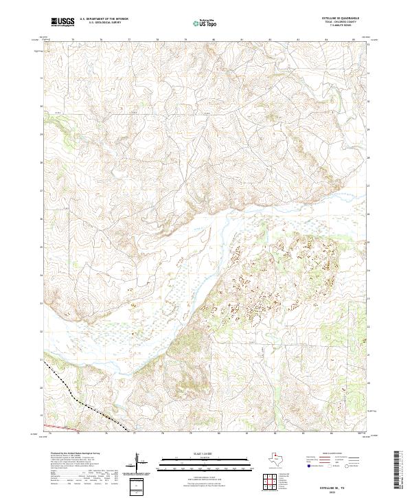
2022 Map of Estelline SE
USGS Topo · Published 2022About this map
The Prairie Dog Town Fork Red River dominates this portion of Childress County, carving a broad, sandy braided channel through the Texas Panhandle landscape. In this contemporary 2022 survey, the river’s expansive bed stands in contrast to the numerous ephemeral drainages that feed into it, such as Jonah Cr and Grassy Cr. The terrain is marked by the complex dissection of the plains by these waterways, including Salt Cr to the north and Baylor Cr in the south. Human activity is represented primarily by a grid of rural county roads like Co RD K and Co RD 7, which navigate the high ground between the various creek breaks. This survey illustrates the modern intersection of Texas ranching country and the significant hydrological features that define the region's geography.
Find a feature on this map
11 named features on this map. Tap any name to fly to it.
Don’t see what you’re looking for? This feature index may not catch every label — zoom into the map to look around manually.
Map Details
Editions of this 2022 Estelline SE Map
This is the sole edition of this map. No revisions or reprints were ever made.
Other maps of this area

1954 · Plainview
USGS Topo · 1:250,000

1958 · Plainview
USGS Topo · 1:250,000

1960 · Loco
USGS Topo · 1:62,500

1961 · Estelline
USGS Topo · 1:62,500

1967 · Tell North
USGS Topo · 1:24,000

1967 · Childress
USGS Topo · 1:24,000

1967 · Carey
USGS Topo · 1:24,000

1984 · Estelline NE
USGS Topo · 1:24,000
1984 · Loco
USGS Topo · 1:24,000
1984 · Estelline NW
USGS Topo · 1:24,000