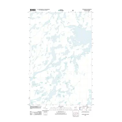
2011 Map of Ester Lake
USGS Topo · Published 2011About this map
Saganaga Lake and the international waters along the border define this landscape of interconnected basins and glacial waterways. In the early 21st century, this area remains a complex network of named water bodies, including Ottertrack Lake and Hanson Lake. The map reveals the critical importance of traditional transit points like Swamp Portage, which connects Mud Bay to Swamp Lake, facilitating movement through the dense collection of smaller basins such as Lake of the Clouds and Cherry Lake. Unlike maps of developed regions, the absence of roads and human structures highlights the persistent character of this wilderness area. The orientation of lakes like Rabbit Lake and Nawakwa Lake provides clear evidence of the geological forces that shaped this region's hydrography.
Find a feature on this map
34 named features on this map. Tap any name to fly to it.
Don’t see what you’re looking for? This feature index may not catch every label — zoom into the map to look around manually.
Map Details
Editions of this 2011 Ester Lake Map
This is the sole edition of this map. No revisions or reprints were ever made.
Other maps of this area

1957 · Quetico
USGS Topo · 1:250,000

1959 · Munker Island
USGS Topo · 1:24,000

1959 · Ogishkemuncie Lake
USGS Topo · 1:24,000

1959 · Kekekabic Lake
USGS Topo · 1:24,000

1959 · Dutton Lake
USGS Topo · 1:24,000

1959 · Gillis Lake
USGS Topo · 1:24,000

1959 · Ester Lake
USGS Topo · 1:24,000

1968 · Quetico
USGS Topo · 1:250,000

1976 · Saganaga Lake
USGS Topo · 1:100,000

1977 · Basswood Lake
USGS Topo · 1:100,000