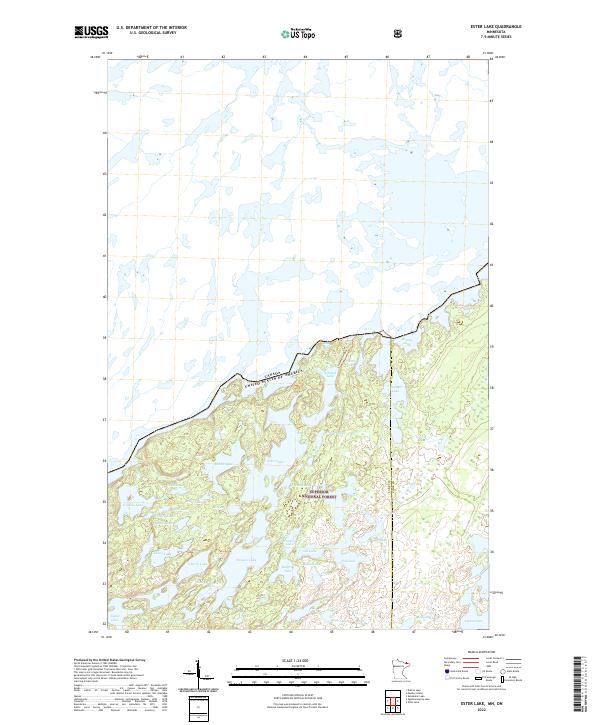
2022 Map of Ester Lake
USGS Topo · Published 2022About this map
The Superior National Forest dominates this northern landscape where the boundary between the United States and Canada is defined by a series of interconnected waterways. This wilderness area, situated along the Lake and Cook County line, is characterized by a dense concentration of glacial lakes including Ester Lake, Rabbit Lake, and Cherry Lake. The map reveals a region largely devoid of modern roads, instead showing primitive pathways like the Swamp-Ashdick Trail that connect isolated water bodies such as Ashdick Lake and Swamp Lake. The intricate shoreline of Mud Bay and the numerous smaller ponds like Gijikiki Lake and Baltic Lake reflect a terrain shaped by post-glacial drainage patterns, essential for understanding historical portage routes and the environmental character of the Boundary Waters region.
Find a feature on this map
39 named features on this map. Tap any name to fly to it.
Don’t see what you’re looking for? This feature index may not catch every label — zoom into the map to look around manually.
Map Details
Editions of this 2022 Ester Lake Map
This is the sole edition of this map. No revisions or reprints were ever made.
Other maps of this area

1957 · Quetico
USGS Topo · 1:250,000

1959 · Munker Island
USGS Topo · 1:24,000

1959 · Ogishkemuncie Lake
USGS Topo · 1:24,000

1959 · Kekekabic Lake
USGS Topo · 1:24,000

1959 · Dutton Lake
USGS Topo · 1:24,000

1959 · Gillis Lake
USGS Topo · 1:24,000

1959 · Ester Lake
USGS Topo · 1:24,000

1968 · Quetico
USGS Topo · 1:250,000

1976 · Saganaga Lake
USGS Topo · 1:100,000

1977 · Basswood Lake
USGS Topo · 1:100,000