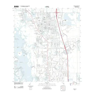
2012 Map of Estero
USGS Topo · Published 2012About this map
Mound Key and the intricate archipelagos of the Gulf of Mexico dominate the western shoreline, illustrating the complex coastal geography of Lee County. The Estero River winds through the landscape, linking established residential developments like Three Oaks and Forest Island Park to the mangrove-fringed coastal keys. This 2012 survey captures the region's suburban maturity, characterized by golf courses and expansive planned communities such as Miromar Lakes. Genealogists and local historians can locate the Koreshan Unity Cem and Johnson Cem, providing tangible links to the area's pioneer heritage and the unique history of the Koreshan Unity settlement. The transportation network is anchored by the Seminole Gulf Railway and arterial routes like Alico Rd and Ben Hill Griffin Pkwy, which support the modern growth of the area near the local university corridor.
Find a feature on this map
49 named features on this map. Tap any name to fly to it.
Don’t see what you’re looking for? This feature index may not catch every label — zoom into the map to look around manually.
Map Details
Editions of this 2012 Estero Map
This is the sole edition of this map. No revisions or reprints were ever made.
Other maps of this area

1956 · West Palm Beach
USGS Topo · 1:250,000

1957 · West Palm Beach
USGS Topo · 1:250,000

1958 · West Palm Beach
USGS Topo · 1:250,000

1958 · Bonita Springs
USGS Topo · 1:24,000

1958 · Corkscrew NW
USGS Topo · 1:24,000

1958 · Estero
USGS Topo · 1:24,000

1958 · Fort Myers SW
USGS Topo · 1:24,000

1958 · Alva SW
USGS Topo · 1:24,000

1958 · Corkscrew SW
USGS Topo · 1:24,000
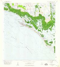
1958 · Fort Myers Beach
USGS Topo · 1:24,000
Featured Places
- Spring Creek Village, FL
- Fountain Lakes, FL
- Residences at Coconut Point, FL
- North Lake Village, FL
- Lighthouse Bay at the Brooks, FL