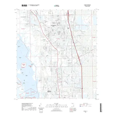
2018 Map of Estero
USGS Topo · Published 2018About this map
Estero and Bonita Springs anchor this coastal survey, where the development of the Gulf Coast intersects with significant historical landmarks and preserved wetlands. The map identifies the Koreshan Unity Cem, a site tied to the religious settlement established along the Estero River, alongside the Johnson Cem further south. The landscape is a intricate network of mangroves and keys, featuring Mound Key and Stingaree Key within the protected waters of Estero Bay.
Find a feature on this map
104 named features on this map. Tap any name to fly to it.
Don’t see what you’re looking for? This feature index may not catch every label — zoom into the map to look around manually.
Map Details
Editions of this 2018 Estero Map
This is the sole edition of this map. No revisions or reprints were ever made.
Other maps of this area

1956 · West Palm Beach
USGS Topo · 1:250,000

1957 · West Palm Beach
USGS Topo · 1:250,000

1958 · West Palm Beach
USGS Topo · 1:250,000

1958 · Bonita Springs
USGS Topo · 1:24,000

1958 · Corkscrew NW
USGS Topo · 1:24,000

1958 · Estero
USGS Topo · 1:24,000

1958 · Fort Myers SW
USGS Topo · 1:24,000

1958 · Alva SW
USGS Topo · 1:24,000

1958 · Corkscrew SW
USGS Topo · 1:24,000
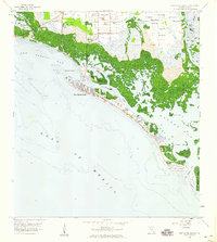
1958 · Fort Myers Beach
USGS Topo · 1:24,000
Featured Places
- Spring Creek Village, FL
- Fountain Lakes, FL
- Residences at Coconut Point, FL
- North Lake Village, FL
- Lighthouse Bay at the Brooks, FL