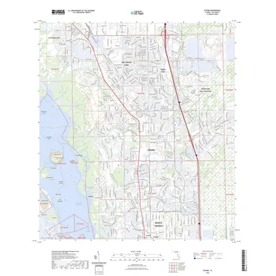
2024 Map of Estero
USGS Topo · Published 2024About this map
The estuarine waters of Estero Bay and the Gulf of Mexico dominate the western portion of this 2024 landscape, where the Intracoastal Waterway threads behind barrier landforms like Big Hickory Island and Lovers Key. In the interior, the map documents the dense suburban corridor between San Carlos Park and Bonita Springs, centered on the historic community of Estero. Notable cultural landmarks include the Florida Gulf Coast University campus and several significant burial grounds, such as Koreshan Unity Cem and Koreshan Cem - 2, which tie the modern development back to earlier communal settlements.
Find a feature on this map
271 named features on this map. Tap any name to fly to it.
Don’t see what you’re looking for? This feature index may not catch every label — zoom into the map to look around manually.
Map Details
Editions of this 2024 Estero Map
This is the sole edition of this map. No revisions or reprints were ever made.
Other maps of this area

1956 · West Palm Beach
USGS Topo · 1:250,000

1957 · West Palm Beach
USGS Topo · 1:250,000

1958 · West Palm Beach
USGS Topo · 1:250,000

1958 · Bonita Springs
USGS Topo · 1:24,000

1958 · Corkscrew NW
USGS Topo · 1:24,000

1958 · Estero
USGS Topo · 1:24,000

1958 · Fort Myers SW
USGS Topo · 1:24,000

1958 · Alva SW
USGS Topo · 1:24,000

1958 · Corkscrew SW
USGS Topo · 1:24,000
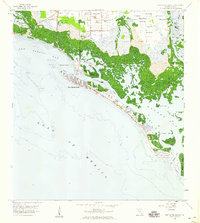
1958 · Fort Myers Beach
USGS Topo · 1:24,000
Featured Places
- Spring Creek Village, FL
- Fountain Lakes, FL
- Residences at Coconut Point, FL
- North Lake Village, FL
- Lighthouse Bay at the Brooks, FL