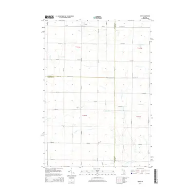
2014 Map of Estey
USGS Topo · Published 2014About this map
Estey serves as the primary settlement on this landscape where Gladwin, Bay, and Midland counties converge. The terrain is defined by a dense network of water management, with numerous named waterways like Chubb Drain, Herner Drain, and Wright Drain feeding into larger systems. This agricultural and rural drainage pattern reflects the long-standing efforts to reclaim and maintain the flatlands of east-central Michigan. The northern reaches are drained by the Pinconning River and its S Br Pinconning River, while the southern half is dominated by the winding path of Kawkawlin Cr and the N Br Kawkawlin River. The orderly grid of roads, such as Estey Rd and Townline 16 Rd, highlights the township's structure as it existed in 2014, providing a clear view of property access and rural development at the start of the 21st century.
Find a feature on this map
55 named features on this map. Tap any name to fly to it.
Don’t see what you’re looking for? This feature index may not catch every label — zoom into the map to look around manually.
Map Details
Editions of this 2014 Estey Map
This is the sole edition of this map. No revisions or reprints were ever made.
Other maps of this area

1934 · Sanford
USGS Topo · 1:62,500

1936 · Sanford
USGS Topo · 1:62,500

1954 · Midland
USGS Topo · 1:250,000

1958 · Midland
USGS Topo · 1:250,000

1959 · Midland
USGS Topo · 1:250,000

1962 · Willard
USGS Topo · 1:24,000

1962 · Midland North
USGS Topo · 1:24,000

1966 · Midland
USGS Topo · 1:250,000
1967 · Mount Forest
USGS Topo · 1:24,000
1967 · Crump
USGS Topo · 1:24,000