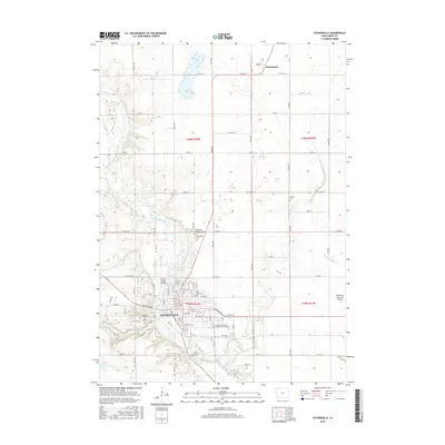
2015 Map of Estherville
USGS Topo · Published 2015About this map
The Des Moines River winds through this Emmet County landscape, providing the geographic anchor for the city of Estherville and the surrounding prairie townships. In the northern reaches of the quadrangle, Eagle Lake sits within a matrix of section lines and rural routes, while the small settlement of Huntington marks the northern corridor near the state line. The map records a dense concentration of local heritage sites, particularly cemeteries like Oak Hill Cem, East Side Cem, and the Norwegian Cem, reflecting the early settlement patterns of the region.
Find a feature on this map
44 named features on this map. Tap any name to fly to it.
Don’t see what you’re looking for? This feature index may not catch every label — zoom into the map to look around manually.
Map Details
Editions of this 2015 Estherville Map
This is the sole edition of this map. No revisions or reprints were ever made.
Other maps of this area

1954 · Fairmont
USGS Topo · 1:250,000

1958 · Fairmont
USGS Topo · 1:250,000

1970 · Ceylon
USGS Topo · 1:24,000

1970 · Jackson
USGS Topo · 1:24,000

1970 · Dunnell
USGS Topo · 1:24,000

1972 · Terril
USGS Topo · 1:24,000

1972 · Wallingford
USGS Topo · 1:24,000

1972 · Estherville
USGS Topo · 1:24,000
1972 · Superior
USGS Topo · 1:24,000

1980 · Ingham Lake
USGS Topo · 1:24,000