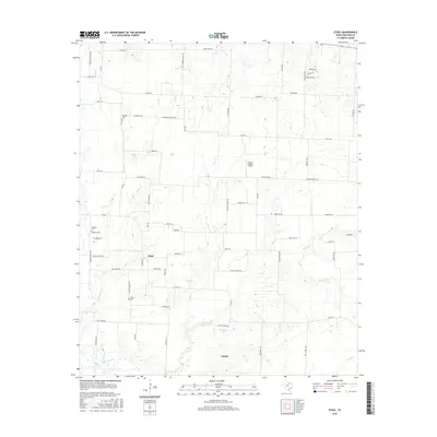
2016 Map of Ethel
USGS Topo · Published 2016About this map
Ethel and Gunter serve as the primary hubs of this North Texas landscape, where a dense network of country roads connects family-named landmarks and rural burial grounds. The territory is defined by its complex drainage systems, with Little Elm Cr and Range Cr cutting through the terrain towards significant water bodies like Touchstone Lake and Gressett Lake. For those tracing local history, the map preserves the locations of Walthall Cem, Ethel Cem, and Macomb Cem, often situated near older road alignments like Macomb Cemetery Rd. The rural character is punctuated by the Flying S Ranch Airport, while the grid-like progression of rural routes such as FM 902 E and Southmayd Rd illustrates the transition from traditional ranching lands to contemporary rural development.
Find a feature on this map
72 named features on this map. Tap any name to fly to it.
Don’t see what you’re looking for? This feature index may not catch every label — zoom into the map to look around manually.
Map Details
Editions of this 2016 Ethel Map
This is the sole edition of this map. No revisions or reprints were ever made.
Other maps of this area

1901 · Denison
USGS Topo · 1:125,000

1954 · Sherman
USGS Topo · 1:250,000

1958 · Dorchester
USGS Topo · 1:24,000

1958 · Sherman NW
USGS Topo · 1:24,000

1958 · Whitesboro
USGS Topo · 1:62,500

1958 · Sherman
USGS Topo · 1:250,000

1958 · Sherman
USGS Topo · 1:62,500

1961 · Gunter
USGS Topo · 1:24,000

1961 · Pilot Point
USGS Topo · 1:24,000
1961 · Marilee
USGS Topo · 1:24,000