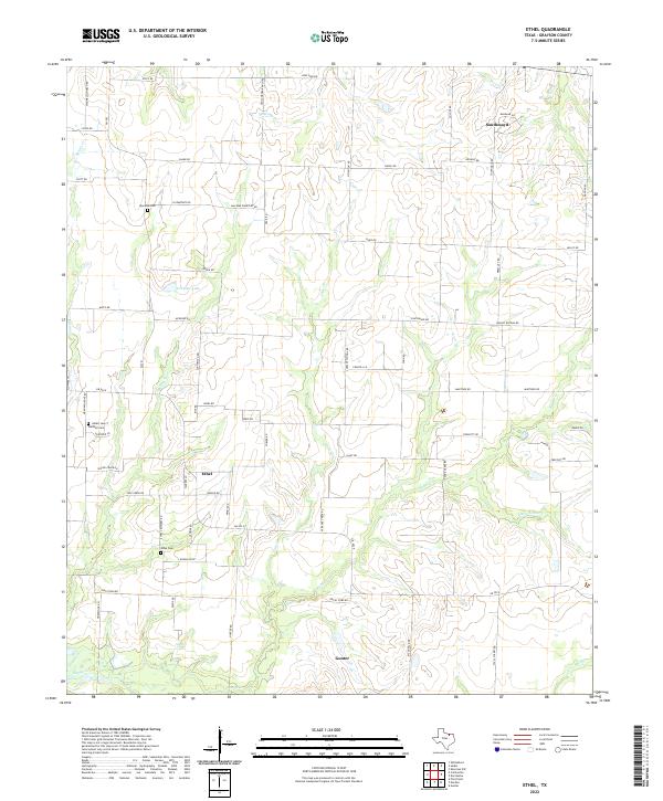
2022 Map of Ethel
USGS Topo · Published 2022About this map
Gunter and Southmayd anchor this Grayson County landscape, characterized by a dendritic drainage pattern of small creeks that feed the North Texas plains. The settlement of Ethel sits at a crossroads in the central part of the map, surrounded by rural family-named roads like Boren Rd and Johnny Watson Rd. This 2022 survey details a terrain defined by subtle elevation changes and numerous watercourses, including Mustang Cr, Hog Cr, and Little Elm Cr.
Find a feature on this map
52 named features on this map. Tap any name to fly to it.
Don’t see what you’re looking for? This feature index may not catch every label — zoom into the map to look around manually.
Map Details
Editions of this 2022 Ethel Map
This is the sole edition of this map. No revisions or reprints were ever made.
Other maps of this area

1901 · Denison
USGS Topo · 1:125,000

1954 · Sherman
USGS Topo · 1:250,000

1958 · Dorchester
USGS Topo · 1:24,000

1958 · Sherman NW
USGS Topo · 1:24,000

1958 · Whitesboro
USGS Topo · 1:62,500

1958 · Sherman
USGS Topo · 1:250,000

1958 · Sherman
USGS Topo · 1:62,500

1961 · Gunter
USGS Topo · 1:24,000

1961 · Pilot Point
USGS Topo · 1:24,000
1961 · Marilee
USGS Topo · 1:24,000