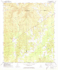
1972 Map of Ethel SE
USGS Topo · Published 1973About this map
The county borders of Attala, Choctaw, and Winston intersect in this rural landscape, characterized by a dense network of country churches and family burial grounds. Small communities such as Rural Hill and Hinze serve as anchors in a terrain deeply carved by Lobutcha Creek and its many tributaries, including Sand Creek and McQuirter Creek. The presence of the McCool Lookout Tower on a high ridge underscores the importance of timber and fire management in this heavily wooded region during the early 1970s.
Find a feature on this map
31 named features on this map. Tap any name to fly to it.
Don’t see what you’re looking for? This feature index may not catch every label — zoom into the map to look around manually.
Map Details
Editions of this 1972 Ethel SE Map
This is the sole edition of this map. No revisions or reprints were ever made.
Other maps of this area

1953 · Meridian
USGS Topo · 1:250,000

1953 · West Point
USGS Topo · 1:250,000

1957 · Meridian
USGS Topo · 1:250,000

1958 · West Point
USGS Topo · 1:250,000

1962 · Edinburg
USGS Topo · 1:62,500

1963 · West Point
USGS Topo · 1:250,000

1965 · Meridian
USGS Topo · 1:250,000

1972 · McCool
USGS Topo · 1:24,000

1972 · Highpoint
USGS Topo · 1:24,000
1972 · Ethel North
USGS Topo · 1:24,000