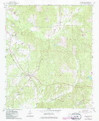
1966 Map of Ethelsville
USGS Topo · Published 1986About this map
Ethelsville and the surrounding timberlands of western Alabama are defined by the winding paths of Magby Creek, Kincaide Creek, and Nash Creek during the mid-1960s. This survey records a landscape where rural community life centered on numerous country houses of worship and education, including Liberty High Sch, Hickory Grove Ch, and Providence Ch. The Illinois Central Gulf railroad corridor cuts diagonally through the terrain, serving the small settlements of Delma and McShan, while the northern border reaches into the community of Stafford.
Find a feature on this map
28 named features on this map. Tap any name to fly to it.
Don’t see what you’re looking for? This feature index may not catch every label — zoom into the map to look around manually.
Map Details
Editions of this 1966 Ethelsville Map
3 editions found
Other maps of this area

1953 · West Point
USGS Topo · 1:250,000

1958 · West Point
USGS Topo · 1:250,000

1960 · Caledonia
USGS Topo · 1:62,500

1960 · Columbus
USGS Topo · 1:62,500

1963 · West Point
USGS Topo · 1:250,000

1966 · Ethelsville
USGS Topo · 1:24,000

1966 · Reform SW
USGS Topo · 1:24,000

1967 · Carrollton
USGS Topo · 1:24,000

1967 · Millport
USGS Topo · 1:24,000
1967 · Reform
USGS Topo · 1:24,000