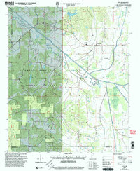
2000 Map of Etta
USGS Topo · Published 2003About this map
The Holly Springs National Forest dominates the western landscape of this 2000 revision, marking a region where public timberlands meet the small-scale agricultural life of North Mississippi. The Little Tallahatchie River cuts through the center, flanked by the Darden Hills and a network of named waterways including Lappatubby Creek and Mud Creek. These creek bottoms and ridges are dotted with established rural landmarks, from the West Union Sch to community centers like Enterprise and Pinedale.
Find a feature on this map
35 named features on this map. Tap any name to fly to it.
Don’t see what you’re looking for? This feature index may not catch every label — zoom into the map to look around manually.
Map Details
Editions of this 2000 Etta Map
This is the sole edition of this map. No revisions or reprints were ever made.
Other maps of this area

1942 · Denmark
USGS Topo · 1:62,500

1943 · Denmark
USGS Topo · 1:62,500

1944 · Potts Camp
USGS Topo · 1:62,500

1945 · Potts Camp
USGS Topo · 1:62,500

1949 · New Albany
USGS Topo · 1:62,500

1951 · New Albany
USGS Topo · 1:62,500

1955 · Blue Mountain
USGS Topo · 1:62,500

1956 · Tupelo
USGS Topo · 1:250,000

1958 · Tupelo
USGS Topo · 1:250,000

1980 · Northwest Pontotoc
USGS Topo · 1:24,000