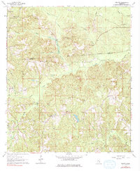
1964 Map of Eucutta
USGS Topo · Published 1976About this map
The Old Indian Treaty Boundary and Old Indian Boundary cut directly through this landscape, marking historic geopolitical lines across what is now the Clarke Co and Wayne Co border. At the heart of the district lies Eucutta, a community defined by its proximity to the Tampa Oil Field and the surrounding network of waterways like Bogue Flower Creek and Eucutta Creek. The map reveals a deeply rooted social landscape of small country churches and family-named cemeteries, including Pleasant Grove Ch, Tribulation Ch, and the Concord Cem. Industrial activity is evident not just in the oil fields but in several scattered sites like the Gravel Pits and various claypits. The terrain is notably defined by Water Ridge, which separates the diverse drainage basins of Mingo Creek and Wolf Creek.
Find a feature on this map
36 named features on this map. Tap any name to fly to it.
Don’t see what you’re looking for? This feature index may not catch every label — zoom into the map to look around manually.
Map Details
Editions of this 1964 Eucutta Map
2 editions found
Other maps of this area

1953 · Hattiesburg
USGS Topo · 1:250,000

1958 · Hattiesburg
USGS Topo · 1:250,000

1963 · Heidelberg
USGS Topo · 1:24,000

1964 · Heidelberg SW
USGS Topo · 1:24,000

1964 · Eucutta
USGS Topo · 1:24,000

1964 · Myrick
USGS Topo · 1:24,000

1964 · Hale
USGS Topo · 1:24,000

1964 · De Soto
USGS Topo · 1:24,000

1964 · Waynesboro
USGS Topo · 1:24,000

1964 · Whistler
USGS Topo · 1:24,000