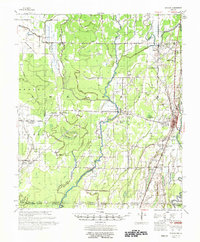
1957 Map of Eudora
USGS Topo · Published 1975About this map
Eudora serves as the primary hub of this 1950s landscape, situated in a region defined by complex hydrological networks and the Missouri Pacific railroad. The terrain is crisscrossed by an intricate system of bayous, including Bayou Macon, Boeuf River, and Lafourche Bayou, which dictate the placement of roads and settlements. This survey reflects the mid-century social fabric of southeast Arkansas and northeast Louisiana, evidenced by a high density of rural religious and educational centers.
Find a feature on this map
53 named features on this map. Tap any name to fly to it.
Don’t see what you’re looking for? This feature index may not catch every label — zoom into the map to look around manually.
Map Details
Editions of this 1957 Eudora Map
2 editions found

Other maps of this area

1909 · Millikin
USGS Topo · 1:24,000

1909 · Ashton Bridge
USGS Topo · 1:24,000

1912 · Ashton Bridge
USGS Topo · 1:31,680

1935 · Mist
USGS Topo · 1:62,500

1935 · Wilmot
USGS Topo · 1:62,500

1935 · Oak Grove
USGS Topo · 1:62,500

1935 · Bonita
USGS Topo · 1:62,500

1936 · Eudora
USGS Topo · 1:62,500

1936 · Lake Village
USGS Topo · 1:62,500

1939 · Readland
USGS Topo · 1:62,500