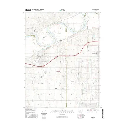
2015 Map of Eudora
USGS Topo · Published 2015About this map
The Kansas River and Wakarusa River converge near the city of Eudora, a central point on this 2015 survey that spans the borders of Douglas, Leavenworth, and Johnson counties. This area is characterized by the wide, winding floodplains of the Kansas River, where smaller settlements like Fall Leaf, Weaver, and Linwood are situated. The southern portion of the map transitions into higher ground, featuring Observation Bluff and the headwaters of Captain Creek and Spoon Creek.
Find a feature on this map
64 named features on this map. Tap any name to fly to it.
Don’t see what you’re looking for? This feature index may not catch every label — zoom into the map to look around manually.
Map Details
Editions of this 2015 Eudora Map
This is the sole edition of this map. No revisions or reprints were ever made.
Other maps of this area

1885 · Lawrence
USGS Topo · 1:125,000

1886 · Oskaloosa
USGS Topo · 1:125,000

1887 · Olathe
USGS Topo · 1:125,000

1888 · Oskaloosa
USGS Topo · 1:125,000

1889 · Lawrence
USGS Topo · 1:125,000

1890 · Kansas City
USGS Topo · 1:125,000

1893 · Olathe
USGS Topo · 1:125,000

1894 · Kansas City
USGS Topo · 1:125,000

1894 · Oskaloosa
USGS Topo · 1:125,000

1934 · Bonner Springs
USGS Topo · 1:48,000