1978 Map of Eufaula
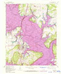
USGS Topo · Published 1979This historical map portrays the area of Eufaula in 1978, primarily covering McIntosh County as well as portions of Pittsburg County, Sequoyah County, Hughes County, Okmulgee County, Haskell County, Okfuskee County, Latimer County, and Muskogee County. Featuring a scale of 1:100000, this map provides a highly detailed snapshot of the terrain, roads, buildings, counties, and historical landmarks in the Eufaula region at the time. Published in 1979, it is the sole known edition of this map.
Find a feature on this map
73 named features on this map. Tap any name to fly to it.
Don’t see what you’re looking for? This feature index may not catch every label — zoom into the map to look around manually.
Map Details
Editions of this 1978 Eufaula Map
This is the sole edition of this map. No revisions or reprints were ever made.