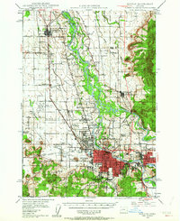
1946 Map of Eugene
USGS Topo · Published 1963About this map
The Willamette River and McKenzie River converge in this mid-century survey, anchoring the developing urban centers of Eugene and Springfield. The landscape is characterized by a dense network of rural school districts and small rail-side settlements like Irving, Santa Clara, and the interestingly named Stumptown. Heavy infrastructure defines the valley floor, with the Southern Pacific and Oregon Electric railroads providing critical transport links alongside the Siuslaw Highway.
Find a feature on this map
59 named features on this map. Tap any name to fly to it.
Don’t see what you’re looking for? This feature index may not catch every label — zoom into the map to look around manually.
Map Details
Editions of this 1946 Eugene Map
2 editions found

Other maps of this area

1909 · Harrisburg
USGS Topo · 1:31,680

1909 · Rowland
USGS Topo · 1:31,680

1909 · Elmira
USGS Topo · 1:62,500

1910 · Eugene
USGS Topo · 1:62,500

1911 · Monroe
USGS Topo · 1:31,680

1912 · Halsey
USGS Topo · 1:62,500

1921 · Brownsville
USGS Topo · 1:62,500

1921 · Cottage Grove
USGS Topo · 1:62,500

1922 · Monroe
USGS Topo · 1:62,500

1922 · Elmira
USGS Topo · 1:62,500