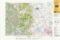
1992 Map of Eugene
USGS Topo · Published 1992About this map
The Willamette River valley and the dense timberlands of the Siuslaw National Forest dominate this regional landscape in the early 1990s. The urban centers of Eugene and Springfield are shown in detail, anchored by the confluence of the Willamette River and Amazon Creek. To the west, the landscape transitions from the agricultural flats of the valley into the Coast Range, where peaks like Roman Nose Mountain and Prairie Peak rise above the complex network of the Siuslaw River and Lake Creek.
Find a feature on this map
102 named features on this map. Tap any name to fly to it.
Don’t see what you’re looking for? This feature index may not catch every label — zoom into the map to look around manually.
Map Details
Editions of this 1992 Eugene Map
This is the sole edition of this map. No revisions or reprints were ever made.
Other maps of this area

1909 · Harrisburg
USGS Topo · 1:31,680

1909 · Rowland
USGS Topo · 1:31,680

1909 · Elmira
USGS Topo · 1:62,500

1910 · Eugene
USGS Topo · 1:62,500

1911 · Brownsville
USGS Topo · 1:31,680

1911 · Lebanon
USGS Topo · 1:31,680

1911 · Monroe
USGS Topo · 1:31,680

1911 · Tangent
USGS Topo · 1:31,680

1911 · Inavale
USGS Topo · 1:31,680

1912 · Halsey
USGS Topo · 1:62,500