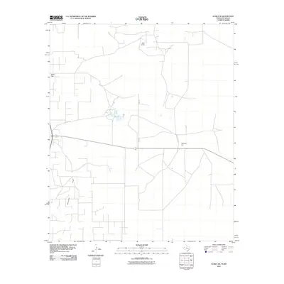
2010 Map of Eunice NE
USGS Topo · Published 2010About this map
Elliott Littman Oil Field and a network of service roads dominate this section of the Permian Basin, where industrial activity and energy extraction define the landscape. The small settlement of Jones City sits along the western edge of the quadrangle, serving as a rare residential node amidst the expansive oil and gas infrastructure. To the south and east, the terrain is shaped by the ephemeral Monument Draw, which snakes through the arid plains toward Windmill Hill. The map meticulously details a geometric grid of local routes such as Wallach Ln and County Rd 9701, illustrating the intensive land use required to support the region's energy economy. These infrastructure patterns provide clear evidence of the logistical complexity involved in operating remote oil fields in the high desert of Lea County.
Find a feature on this map
8 named features on this map. Tap any name to fly to it.
Don’t see what you’re looking for? This feature index may not catch every label — zoom into the map to look around manually.
Map Details
Editions of this 2010 Eunice NE Map
This is the sole edition of this map. No revisions or reprints were ever made.
Other maps of this area

1954 · Hobbs
USGS Topo · 1:250,000

1958 · Hobbs
USGS Topo · 1:250,000

1969 · Hobbs SW
USGS Topo · 1:24,000

1969 · Eunice
USGS Topo · 1:24,000

1969 · Hobbs SE
USGS Topo · 1:24,000

1969 · Eunice NE
USGS Topo · 1:24,000

1969 · Eunice SE
USGS Topo · 1:24,000

1969 · Rattlesnake Canyon
USGS Topo · 1:24,000

1971 · Brinson Ranch
USGS Topo · 1:24,000

1971 · Jumbo Hill
USGS Topo · 1:24,000