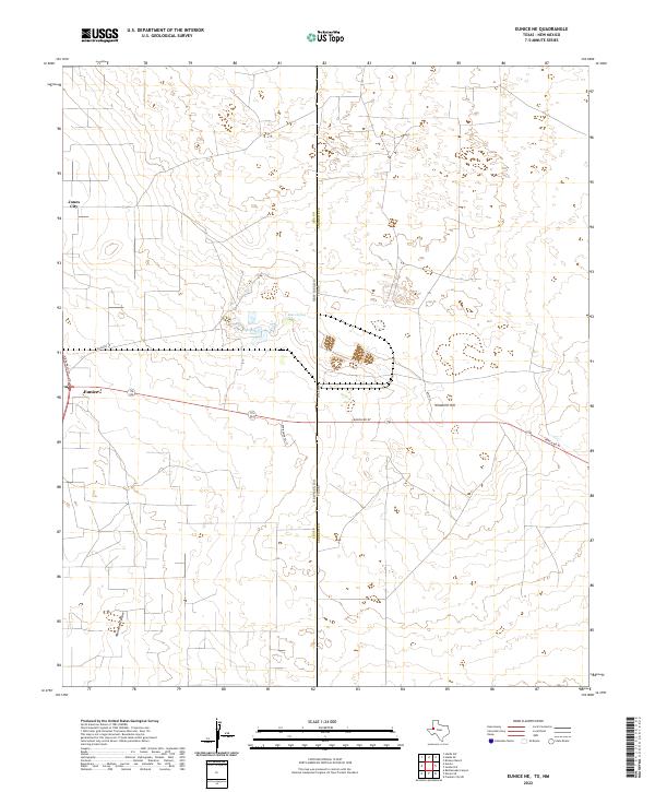
2022 Map of Eunice NE
USGS Topo · Published 2022About this map
Eunice and the nearby settlement of Jones City anchor this West Texas landscape, positioned right along the state line between Lea County, New Mexico, and Andrews County, Texas. This 2022 survey documents the modern layout of this energy-producing region, where a network of industrial and rural roads like Ranch RD 87 and Wallach Ln cut through the arid terrain. Natural landmarks provide contrast to the developed corridors, including the topographic rise of Windmill Hill and the intermittent drainage of Monument Draw. In the northern portion of the quadrangle, Baker Spring remains a notable water feature in an otherwise dry environment. The map clearly delineates the administrative boundary between the two states, offering a contemporary look at the infrastructure and land divisions that define this borderland today.
Find a feature on this map
18 named features on this map. Tap any name to fly to it.
Don’t see what you’re looking for? This feature index may not catch every label — zoom into the map to look around manually.
Map Details
Editions of this 2022 Eunice NE Map
This is the sole edition of this map. No revisions or reprints were ever made.
Other maps of this area

1954 · Hobbs
USGS Topo · 1:250,000

1958 · Hobbs
USGS Topo · 1:250,000

1969 · Hobbs SW
USGS Topo · 1:24,000

1969 · Eunice
USGS Topo · 1:24,000

1969 · Hobbs SE
USGS Topo · 1:24,000

1969 · Eunice NE
USGS Topo · 1:24,000

1969 · Eunice SE
USGS Topo · 1:24,000

1969 · Rattlesnake Canyon
USGS Topo · 1:24,000

1971 · Brinson Ranch
USGS Topo · 1:24,000

1971 · Jumbo Hill
USGS Topo · 1:24,000