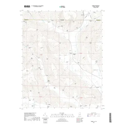
2018 Map of Eureka
USGS Topo · Published 2018About this map
Crow Creek Valley and the surrounding highlands of Jackson County dominate this landscape along the Alabama-Tennessee border. Small settlements like Pleasant Grove and Bass are situated along the valley floor, while the surrounding ridges are marked by isolated landmarks such as Summers Top and Steele Point. The area's genealogical history is well-preserved through numerous family and community burial grounds, including the Cumberland Cem and McCrary Cem. The drainage patterns of Little Coon Cr and Little Crow Cr define the local topography, carving deep hollows like Sumach Hollow and Jacoway Hollow. To the south, the settlement of Allison sits near the confluence of Big Coon Creek, where the terrain begins to transition toward the Big Coon Valley. The map also captures several natural springs, including Champion Spring and Blue Spring, which historically served as vital water sources for these upland communities.
Find a feature on this map
102 named features on this map. Tap any name to fly to it.
Don’t see what you’re looking for? This feature index may not catch every label — zoom into the map to look around manually.
Map Details
Editions of this 2018 Eureka Map
This is the sole edition of this map. No revisions or reprints were ever made.
Other maps of this area

1886 · Stevenson
USGS Topo · 1:125,000

1888 · Scottsboro
USGS Topo · 1:125,000

1892 · Scottsboro
USGS Topo · 1:125,000

1892 · Stevenson
USGS Topo · 1:125,000

1895 · Stevenson
USGS Topo · 1:125,000

1895 · Sewanee
USGS Topo · 1:125,000

1928 · Decherd
USGS Topo · 1:62,500

1936 · Orme
USGS Topo · 1:24,000

1936 · Wannville
USGS Topo · 1:24,000

1936 · Sinking Cove
USGS Topo · 1:24,000