
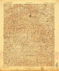
1901 Map of Eureka Springs
USGS Topo · Published 1901About this map
Eureka Springs anchors this 1901 survey of the Ozarks, appearing as a significant mountain settlement defined by the winding course of the Kings River and White River. The map reveals a landscape heavily reliant on river crossings before the era of modern bridges, noting essential transit points like Knox Ferry, Huffman Ford, and Jennings Ford. These crossings connected isolated townships such as Clifty, Alabam, and Omega, while the county seat at Huntsville serves as a southern hub.
Find a feature on this map
152 named features on this map. Tap any name to fly to it.
Don’t see what you’re looking for? This feature index may not catch every label — zoom into the map to look around manually.
Map Details
Editions of this 1901 Eureka Springs Map
3 editions found

Other maps of this area

1898 · Winslow
USGS Topo · 1:125,000

1899 · Fayetteville
USGS Topo · 1:125,000

1900 · Eureka Springs
USGS Topo · 1:125,000

1901 · Winslow
USGS Topo · 1:125,000

1901 · Fayetteville
USGS Topo · 1:125,000

1904 · Fayetteville
USGS Topo · 1:125,000

1904 · Harrison
USGS Topo · 1:125,000

1905 · Harrison
USGS Topo · 1:125,000

1907 · Forsyth
USGS Topo · 1:125,000

1927 · Shell Knob
USGS Topo · 1:62,500