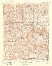
1944 Map of Eureka
USGS Topo · Published 1944About this map
The Meramec River and Missouri River define the southern and northern boundaries of this mid-century landscape in western St. Louis County. The area is characterized by a high density of rural social centers, including the Bethany Ch and Zion Ch, alongside several local educational hubs like Melrose Sch and Wildhorse Creek Sch. The northern portion is dominated by the sprawling Babler State Park, which at the time of this survey contained a CCC Camp, a remnant of Depression-era public works.
Find a feature on this map
41 named features on this map. Tap any name to fly to it.
Don’t see what you’re looking for? This feature index may not catch every label — zoom into the map to look around manually.
Map Details
Editions of this 1944 Eureka Map
3 editions found
Other maps of this area

1901 · De Soto
USGS Topo · 1:125,000

1903 · O'Fallon
USGS Topo · 1:125,000

1931 · Manchester SE
USGS Topo · 1:24,000

1931 · Pacific NE
USGS Topo · 1:24,000

1932 · Manchester NE
USGS Topo · 1:24,000

1937 · Pacific
USGS Topo · 1:24,000

1937 · Weldon Spring
USGS Topo · 1:24,000

1940 · Eureka
USGS Topo · 1:24,000

1940 · Weldon Spring
USGS Topo · 1:24,000

1944 · Eureka
USGS Topo · 1:24,000