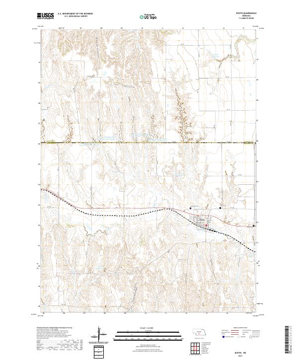
2021 Map of Eustis
USGS Topo · Published 2021About this map
Eustis anchors the intersection of several local routes in this recent survey of the Frontier and Dawson County line. The settlement's layout is clearly defined by Hendricks St and Windom St, with the railway influence preserved in the naming of W Railroad St and E Railroad St. The surrounding high plains landscape is deeply incised by a series of north-south drainages including Midway Canyon and Horseshoe Canyon, which feed into the Plum Cr system. Local water management is a primary feature of the agricultural economy here, evidenced by numerous named impoundments such as Hueftle Reservoir, Koch Reservoir, and several numbered Dawson Company Road dams. For genealogists and local historians, the map identifies three distinct burial sites: Westview Cem and Eustis East Cem near the town center, and the more remote Pioneer Cem to the east.
Find a feature on this map
34 named features on this map. Tap any name to fly to it.
Don’t see what you’re looking for? This feature index may not catch every label — zoom into the map to look around manually.
Map Details
Editions of this 2021 Eustis Map
This is the sole edition of this map. No revisions or reprints were ever made.
Other maps of this area

1896 · Lexington
USGS Topo · 1:125,000

1899 · Lexington
USGS Topo · 1:125,000

1902 · Gothenburg
USGS Topo · 1:125,000

1954 · McCook
USGS Topo · 1:250,000

1955 · Grand Island
USGS Topo · 1:250,000

1957 · McCook
USGS Topo · 1:250,000

1957 · Grand Island
USGS Topo · 1:250,000

1958 · McCook
USGS Topo · 1:250,000

1958 · Grand Island
USGS Topo · 1:250,000
1970 · Eustis SW
USGS Topo · 1:24,000