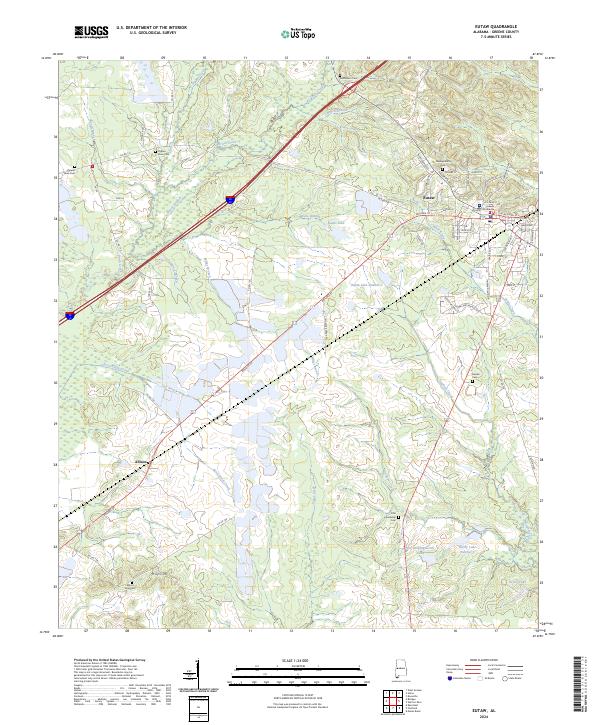
2024 Map of Eutaw
USGS Topo · Published 2024About this map
Eutaw serves as the focal point of this Greene County survey, centered around the Greene County Courthouse and a dense network of streets like Mesopotamia St and Tuscaloosa St. The surrounding landscape is defined by the winding paths of Bean Stalk Creek and Brush Creek, which flow through a region characterized by small settlements and numerous family and community burial grounds. Several namesake water bodies, including Odum Lake Number 1 and Doc Hollingsworth Lake, reflect the local drainage patterns into Taylor Creek and Stephens Creek. To the southwest, the community of Allison and the landmark of Hays Mt stand near the Mount Zoar Cem, illustrating the distributed nature of historical rural life. The presence of numerous cemeteries, such as Bethlehem Cem and Pippen Place Cem, provides significant value for researchers tracing local lineage and the social geography of the Black Belt.
Find a feature on this map
71 named features on this map. Tap any name to fly to it.
Don’t see what you’re looking for? This feature index may not catch every label — zoom into the map to look around manually.
Map Details
Editions of this 2024 Eutaw Map
This is the sole edition of this map. No revisions or reprints were ever made.
Other maps of this area

1927 · Eutaw
USGS Topo · 1:48,000

1929 · Epes
USGS Topo · 1:48,000

1931 · Eutaw
USGS Topo · 1:62,500

1932 · Epes
USGS Topo · 1:62,500

1947 · Mason Bend
USGS Topo · 1:24,000

1947 · Forkland
USGS Topo · 1:24,000

1948 · Mason Bend
USGS Topo · 1:24,000

1949 · Forkland
USGS Topo · 1:24,000

1953 · Montgomery
USGS Topo · 1:250,000

1953 · Meridian
USGS Topo · 1:250,000