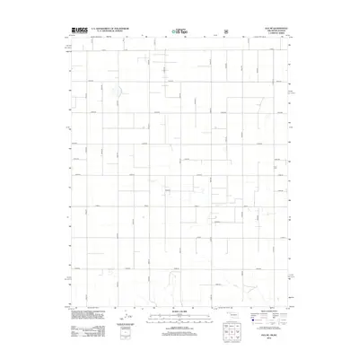
2012 Map of Eva NE
USGS Topo · Published 2012About this map
Kuhn Cem sits in the eastern reaches of this Texas County landscape, providing a specific point of interest for genealogists and local historians exploring the high plains of the Oklahoma Panhandle near the Kansas border. The terrain is defined by a highly organized, rectilinear grid of section roads, including A Blvd, Road F, and Co Hwy-7, reflecting the systematic agricultural development of the region. The intermittent drainage of Cow Cr meanders across the southern half of the map, breaking the geometric precision of the farm plots and road network. This survey captures a rural landscape where the placement of cemeteries and the path of seasonal creeks offer the primary deviations from a sprawling system of named county roads and state highways.
Find a feature on this map
32 named features on this map. Tap any name to fly to it.
Don’t see what you’re looking for? This feature index may not catch every label — zoom into the map to look around manually.
Map Details
Editions of this 2012 Eva NE Map
This is the sole edition of this map. No revisions or reprints were ever made.
Other maps of this area

1954 · Perryton
USGS Topo · 1:250,000

1955 · Dodge City
USGS Topo · 1:250,000

1958 · Perryton
USGS Topo · 1:250,000

1958 · Dodge City
USGS Topo · 1:250,000

1959 · Dodge City
USGS Topo · 1:250,000
1973 · Elkhart South
USGS Topo · 1:24,000

1973 · Eva SE
USGS Topo · 1:24,000
1973 · Elkhart North
USGS Topo · 1:24,000

1973 · Hough SW
USGS Topo · 1:24,000
1973 · Eva
USGS Topo · 1:24,000