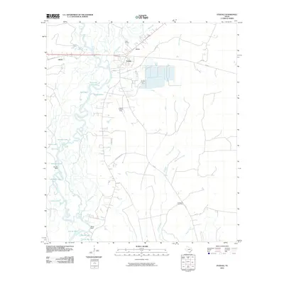
2010 Map of Evadale
USGS Topo · Published 2010About this map
The Neches River winds through a complex system of sloughs and oxbow lakes in this Jasper County landscape, defining the character of eastern Texas at the start of the 21st century. High ground is marked by features like Brushy Bluff and Wiess Bluff, while the low-lying basin is a labyrinth of water bodies including Twin Lakes, Gentry Lake, and the distinctly named Big Mac Lake. The settlement of Evadale serves as a central hub, supported by the Temco and Lillard areas. Cultural markers like the Craig Cemetery and the Evadale Fire Lookout Tower provide specific points of interest for genealogists and local historians. This era shows a landscape where industrial footprints and transportation routes like FM 1131 and the Evadale Landing Strip coexist with the dense, water-saturated terrain of the Bellrose Slough and The Cutoff.
Find a feature on this map
40 named features on this map. Tap any name to fly to it.
Don’t see what you’re looking for? This feature index may not catch every label — zoom into the map to look around manually.
Map Details
Editions of this 2010 Evadale Map
This is the sole edition of this map. No revisions or reprints were ever made.
Other maps of this area

1926 · Lakeview
USGS Topo · 1:24,000

1926 · Texla
USGS Topo · 1:24,000

1932 · Beaumont
USGS Topo · 1:62,500

1943 · Texla
USGS Topo · 1:24,000

1952 · Lake Charles
USGS Topo · 1:250,000

1954 · Lake Charles
USGS Topo · 1:250,000

1954 · Beaumont
USGS Topo · 1:250,000

1955 · Silsbee
USGS Topo · 1:62,500

1955 · Bessmay
USGS Topo · 1:62,500

1957 · Beaumont
USGS Topo · 1:250,000