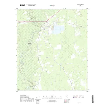
2019 Map of Evadale
USGS Topo · Published 2019About this map
The Neches River forms the primary geographic spine of this Jasper and Hardin County borderland, winding through a complex network of oxbows and backwaters. The landscape is defined by its deep bottomland hydrology, featuring numerous named water bodies like Big Eddy Lake, Cockerham Lake, and the winding The Cutoff channel. Much of the western territory is protected within the Big Thicket National Preserve, preserving the transition between dense forests and wetland environments such as Robinson Marsh and Coon Swamp.
Find a feature on this map
58 named features on this map. Tap any name to fly to it.
Don’t see what you’re looking for? This feature index may not catch every label — zoom into the map to look around manually.
Map Details
Editions of this 2019 Evadale Map
This is the sole edition of this map. No revisions or reprints were ever made.
Other maps of this area

1926 · Lakeview
USGS Topo · 1:24,000

1926 · Texla
USGS Topo · 1:24,000

1932 · Beaumont
USGS Topo · 1:62,500

1943 · Texla
USGS Topo · 1:24,000

1952 · Lake Charles
USGS Topo · 1:250,000

1954 · Lake Charles
USGS Topo · 1:250,000

1954 · Beaumont
USGS Topo · 1:250,000

1955 · Silsbee
USGS Topo · 1:62,500

1955 · Bessmay
USGS Topo · 1:62,500

1957 · Beaumont
USGS Topo · 1:250,000