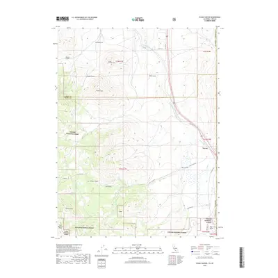
2018 Map of Evans Canyon
USGS Topo · Published 2018About this map
Haskell Peak and Little Haskell Peak dominate the high ground of the Sierra Nevada foothills where California meets Nevada. This 2018 survey documents a transition zone between the managed lands of the Toiyabe National Forest and Tahoe National Forest, and the small outposts of Staverville and Peavine. The landscape is defined by its drainage systems, with Long Valley Cr and Purdy Cr cutting through numerous canyons such as Evans Canyon, Balls Canyon, and Coulee Canyon. The presence of Upper Long Valley and the Bald Mountain Range suggests a rugged geography shaped by the border-straddling topography of Lassen and Sierra Counties in California against the Nevada state line. Roads like Scott Rd and Balls Canyon Rd provide access into this terrain where topographic relief is significant, punctuated by landmarks like Burma Summit.
Find a feature on this map
33 named features on this map. Tap any name to fly to it.
Don’t see what you’re looking for? This feature index may not catch every label — zoom into the map to look around manually.
Map Details
Editions of this 2018 Evans Canyon Map
This is the sole edition of this map. No revisions or reprints were ever made.
Other maps of this area

1890 · Sierraville
USGS Topo · 1:125,000

1891 · Reno
USGS Topo · 1:125,000

1892 · Sierraville
USGS Topo · 1:125,000

1893 · Reno
USGS Topo · 1:125,000

1894 · Sierraville
USGS Topo · 1:125,000

1950 · Chilcoot
USGS Topo · 1:62,500

1950 · Reno
USGS Topo · 1:62,500

1951 · Reno
USGS Topo · 1:62,500

1955 · Loyalton
USGS Topo · 1:62,500

1957 · Dogskin Mountain
USGS Topo · 1:62,500