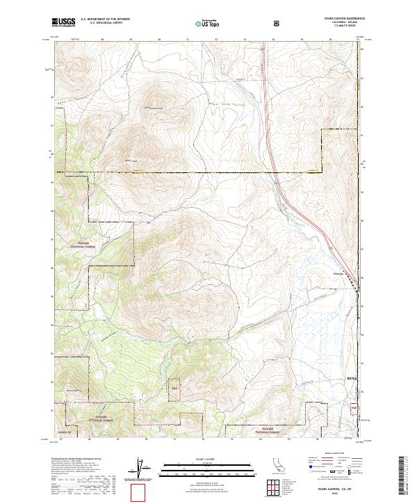
2022 Map of Evans Canyon
USGS Topo · Published 2022About this map
Toiyabe National Forest and the Tahoe NF dominate this high-altitude landscape along the border of California and Nevada. The terrain is defined by the Bold Mountain Range, where peaks like Haskell Peak and Little Haskell Peak overlook a complex network of drainages. Water courses such as Long Valley Creek and Purdy Cr dictate the movement through the region, winding toward the northwestern edge of Reno.
Find a feature on this map
37 named features on this map. Tap any name to fly to it.
Don’t see what you’re looking for? This feature index may not catch every label — zoom into the map to look around manually.
Map Details
Editions of this 2022 Evans Canyon Map
This is the sole edition of this map. No revisions or reprints were ever made.
Other maps of this area

1890 · Sierraville
USGS Topo · 1:125,000

1891 · Reno
USGS Topo · 1:125,000

1892 · Sierraville
USGS Topo · 1:125,000

1893 · Reno
USGS Topo · 1:125,000

1894 · Sierraville
USGS Topo · 1:125,000

1950 · Chilcoot
USGS Topo · 1:62,500

1950 · Reno
USGS Topo · 1:62,500

1951 · Reno
USGS Topo · 1:62,500

1955 · Loyalton
USGS Topo · 1:62,500

1957 · Dogskin Mountain
USGS Topo · 1:62,500