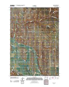
2011 Map of Evans
USGS Topo · Published 2011About this map
Lostine Cemetery and the settlement of Evans anchor this agricultural landscape in Wallowa County, where the Lostine River and Wallowa River converge. The topography is defined by significant water management and natural drainages, including the Westside Ditch and the branching system of Whisky Creek, which includes its North, Middle, and South forks. The rural road network, featuring names like Troy Rd and Jim Town Rd, reflects the historic paths connecting local farms and canyons. Landforms such as Allen Canyon and Spring Branch break the valley floor, illustrating the complex hydrology that supported early 21st-century ranching and farming operations in this corner of the Pacific Northwest.
Find a feature on this map
26 named features on this map. Tap any name to fly to it.
Don’t see what you’re looking for? This feature index may not catch every label — zoom into the map to look around manually.
Map Details
Editions of this 2011 Evans Map
This is the sole edition of this map. No revisions or reprints were ever made.
Other maps of this area

1906 · Telocaset
USGS Topo · 1:125,000

1955 · Grangeville
USGS Topo · 1:250,000

1957 · Enterprise
USGS Topo · 1:62,500

1957 · Sled Springs
USGS Topo · 1:62,500

1959 · Grangeville
USGS Topo · 1:250,000

1964 · Akers Butte
USGS Topo · 1:24,000

1964 · Wallowa
USGS Topo · 1:24,000

1965 · Fox Point
USGS Topo · 1:24,000

1982 · Wallowa
USGS Topo · 1:100,000
1984 · Akers Butte
USGS Topo · 1:24,000